 First Place :: WalkYourPlace by Ebrahim Poorazizi
Congratulations to Mr. Poorazizi, the first prize winner of the inaugural OGC Student App Challenge.
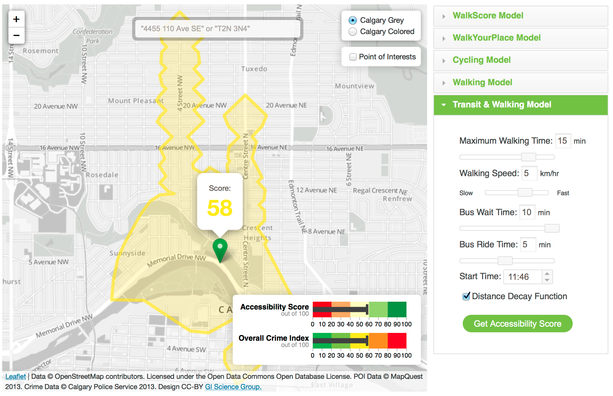
Ebrahim has developed WalkYourPlace, a web-based tool for assessment of accessibility to urban facilities using quality of life indicators, such as the number of grocery stores, shopping and recreation facilities, and local crime. The system evaluates in real time an area that is accessible using pedestrian, transit, and cycling infrastructure. The WalkYourPlace system has been designed and developed based on principles of Spatial Data Infrastructure (SDI) and Service Oriented Architecture (SOA) frameworks to provide data and service interoperability. Try the winning APP here!
 Second Place :: TinySOS by Mohammad Jazayeri
Lightweight profile of the OGC SOS interoperabile, self-contained and self-describable. We have planned to achieve Internet of Things by means of Netduino Plus as a small computer and RestFul API.
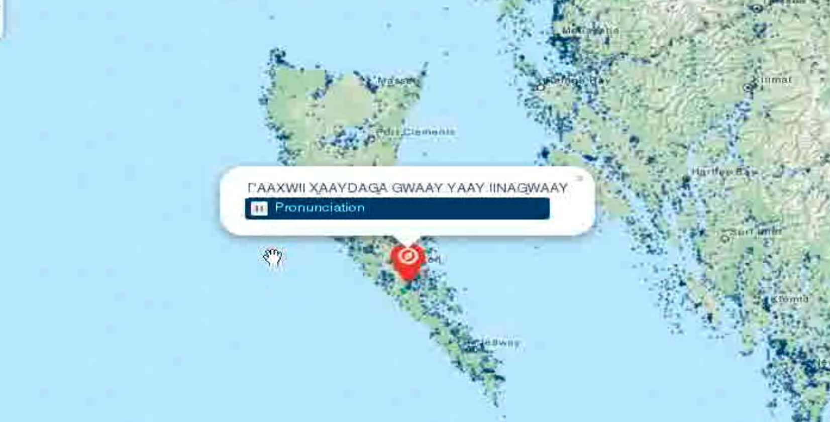
 BC Place Names by Jade Lacosse
The BC place names map app is a web/phone app that uses geolocation to show the user's current location on a Leaflet powered Web Mapping Services (WMS) map. Markers on the map show First Nations place names around the user. The user can click on the markers to hear audio clips of the place names and explore the map. The app uses GeoServer to create a WMS overlay of all known place names in British Columbia, Canada. The backend uses the Drupal Content Management System to allow authorized users to add place names markers and audio clips to the map. The data is stored in a PostGIS database for easy retrieval using spatial queries in addition to more regular relational lookups such as translation, language, dialect, linguistic group, and bibliographic source (for archive recordings).
The web app uses HTML5 standards for audio playback and asynchronous data communications, but contains fallback methods for outdated browsers.
The First Nations Place Names Audio database is used with permission from the First Peoples' Culture Council. The BC Place Names database was provided under British Columbia's Open Data License.
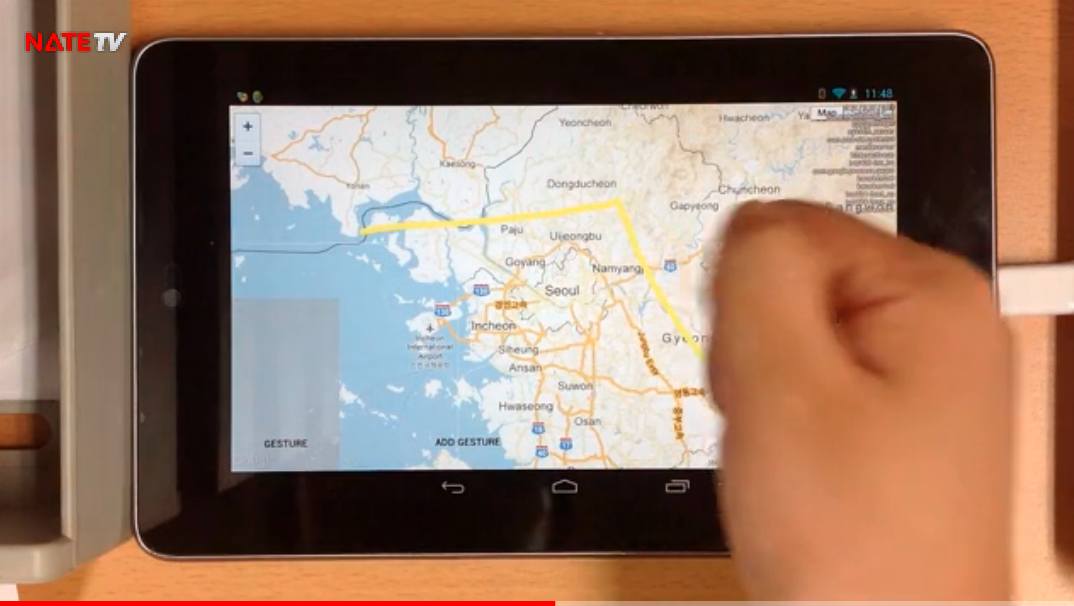
 Android Map Application for People with Disabilities by Soo Jin Lee
Hi. My name is Soo Jin Lee who is a senior student of Pukyong National University and My major is Spatial Information Engineering. Main purpose of my smart mobile app is to provide substitution interface of map service which is provided from general vendors. Generally, famous map apps such as Google map, Bing map and so on, require one finger and two finger when we handle them. Representative examples of the controlling method are ‘Zoom-In’ (two finger), ‘Zoom-out’ (two finger), ‘Rotation’ (two finger) and so on. It means, however, people who don’t have or lost their finger accidentally can’t order these instructions easily. So I produced map application which can support voice and gesture controls. As android speech and gesture API are used, not only people who can’t control general map application but also normal person can control this app easily. Please refer to attached demo video and manual for detailed information. By the way, location data of library for the disabled is used in the form of KML as the data related with OGC standard. Thank you.
Download the APP here or Link to two minute Video